North to Alaska!

The 37 goes north to the Yukon which gets you to northern Alaska. We took 37A which gets you to southern Alaska. It's still pretty far north, latitude 55. 37A is called Glacier Highway. There are lots of glaciers visible from the road.

Lots of glaciers.

This is Bear Glacier. It was pretty cold out. This is where we got the jackets out.

There was a cache near Bear Glacier, about a half mile walk. We started down the abandoned road, towards the clouds. Then we heard branches snapping the woods and remembered why Bear Glacier was so named. Then we turned around and went back to the safety of the van. We know how to deal with rattlers, but not bears!

In Alaska, the NFS has put up a boardwalk over a salmon stream. The salmon spawn and the bears and eagles and ravens feed. We're in the USA!

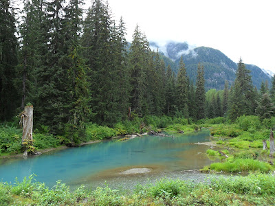
Glacier-fed lakes and streams everywhere.

The salmon were just lazing around in the water. I think they were pretty tired out from all the swimming they had to do to get here. They were pretty territorial and would chase each other out of their sandy burrows. We don't know much about salmon spawning. Maybe they were just resting up here, or maybe they were making baby salmons. Whatever, it was cool. We did not see any bears here (or anywhere). There's a cache nearby, and other people who found it on the day we were there did see both black bears and grizzly bears. We were going to stop back here on the way back from Salmon Glacier, but we had other things to worry about (see previous posts).

An old fireplace on the way back to the van. We wondered what its story was.

Next cache - at an old gold mine. Roads? Where we're going, we don't need roads!

Old mine equipment.

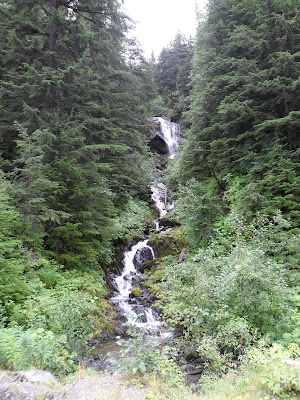
Waterfalls

And more waterfalls.

Waterfalls ending in lakes.

Marmots.

Clouds. Behind these clouds are mountains and glaciers. We couldn't see them on the way up.

The mine entrance. On the other side of this tunnel is a turnaround with a cross. That cross made me remember not to worry, even though we had a flat tire and would travel 450 miles on a donut spare. And there's a cache just inside the entrance.

This empty lake bed is either empty or full. There is an ice dam at the foot of the lake which holds in the runoff from the glacier. When the ice dam finally breaks, in June, there is a flood of water way downstream.

Salmon glacier. This one runs for miles and miles, just like a river.

Leaving Alaska. US customs didn't care that we were entering, but Canada customs did.


1 comment:
Di,
Thanks so much for taking us all along on your travels! It is exciting to see the different places and share in the geocaching.
Tobey
Post a Comment