Monday, August 30, 2010

Washington

We decided to cross the border in Idaho instead of Washington. The wait was about 20 minutes, and I didn't have internet, so I couldn't check on the wait at the so-called busy crossing. But it was a nice day, so who cares.

A couple of fawns at an I just before the border:


Dust devils in eastern Washington:


The Columbia River. This is a really big river!


Electric pinwheels everywhere!


And that's it! Rich and I are off to North Carolina in a couple of weeks. If there's something interesting to share, I'll post it here.

Oh, here's the last view of Mt. Rainier from the airplane. So cool!

Friday, August 27, 2010

Golden, BC

We rented a house in Golden. We had our choice of a fancy cabin in a resort on the mountain or a much cheaper plain house on the river. We chose the cheaper option, and we chose wisely. It wasn't the best house, but it had a hot tub and comfy beds and a kitchen. There's not much else needed on vacation!

The view from the front yard (and the hot tub):


On the other side of the river, there was an adventure camp which offered parachuting. Several times a day, we'd see parachuters coming down for a landing.


Golden is a nice tourist town. They had a grocery store, bookstore, and candy shop. Andrew left his book on the plane, so we checked in at the bookstore to see if they had a copy. Nope, but I did get a cool print of Emerald Lake. The candy shop was fun too.

The train tracks were right by our house. We were worried about trains waking us at 2 am, but that didn't happen. Connor especially loved running out to see how many engines the trains had front and back.

In the mountains between Golden and Banff, there was a neat-o way for the trains to get up and over the hills - spiral tunnels. Here's what it looks like on Google Maps:


In real life they are pretty cool:


At the information stop for the spiral tunnels, they had other tunnels for the little trains!


Ok, so all this talk about trains is really to talk about the steam train that came through Golden on Friday. It was on its way to the west.


Downtown Golden is nice to walk around, including a huge pedestrian bridge crossing the river. Naturally, there's a cache near here.

Thursday, August 26, 2010

Paint Pots

On the way back to Golden after Lake Louise, we wanted to stop at a multicache called Paint Pots. Having been to Yellowstone, we were kind of expecting boiling pots of mud. But these were cold paint pots.

It was raining and the boys were tired, so I went alone on the walk. It was very quiet - nobody else on the trail until I was almost back to the parking lot. I kept whistling and singing to keep the bears away. I used to think that was something they told the tourists, but I didn't get eaten by bears, so maybe it worked.

First up, a suspension bridge! I crossed this thing! Twice!


In the olden days, they mined the yellow and red ocher from here, sending it off to be made into paint. Hence, paint pots. They never picked up the last load of ocher.


Here are the springs, rich in iron oxide. As the iron oxide builds up on the sides of the pool, the hill gets higher. Eventually, the spring is choked off and the water finds another way to get out of the ground. It was raining pretty heavily by this time. I did not bring my raincoat this day, because the forecast was for sun. Ha! I just had my little blue hoodie, hoodie up.


Here's the rain in the valley. It was beautiful and quiet.


The bridge again. When I got back to this bridge, all of a sudden there were lots of people around. One group was just playing on the bridge and in the river. Another family asked me questions about the trail, it was still raining. I told them the cool parts and they decided not to go. Did I mention it was really raining?


I headed up the hill back to the car before they went. I stopped at the top to catch my breath and they passed me. I told them I was from sea level where there is more air.

Tuesday, August 24, 2010

Lake Louise

We took a day to drive from our rental house in Golden to drive over the mountains, find some caches, row on Lake Louise, find some more caches, and drive back over the mountains on a different road, finding more caches along the way. We saw glaciers, waterfalls, and lakes.

We wanted to go rowing. 30 years ago, they rented rowboats, now they only rent canoes. They'll let 4 in a canoe if the two smallest are less than 40 pounds each. Ours aren't. So the boys rowed and I took the trail. Here they are after their safety lesson, getting into the boat.


We were going to meet up at the end of the lake, but they rowed much faster than I walked! Can you see them in this shot?


It was nice to walk on my own, at my own pace, without stumbling over kids!


It was a cloudy, rainy day, but when the sun came out on the lake, the color was amazing.


Looking back from the glacier end of the lake. We had lunch at the hotel when we all got back together. Remind me to never try a potato pizza with honey and truffle oil again. Even writing it now, I wonder what I was thinking.


Is the water cold?


Poppies!


The storm came in just as we were ready to go. It was thundering and all the canoes had to come in off the lake.


It rained the rest of the afternoon, so we missed the $20 view at Moraine Lake. The color of the lake was beautifully dark teal with the cloudy sky, though. Then it rained through a solo hike I took to the paint pots. But honestly, it wasn't too bad. We laughed through most of it and it wasn't like a hill country thunderstorm, just a nice rain.

Friday, August 20, 2010

Takakkaw Falls

Takakkaw Falls (Cree for magnificent) used to be thought to be the highest falls in Canada, but Canada is pretty big, and they found another which is taller. These are tall! You could scrabble up the side for quite a way, and there were also climbers on the sheer cliff face.


Downstream from the falls was a lot of spray, plus the river, rocks, and more waterfalls. It is a lovely spot to spend a few hours.


The boys enjoyed playing in the rocks and tossing them into the river.


See?


Here's a good picture of me.

Tuesday, August 17, 2010

Mt. Edith Cavell and Athabasca Falls

We drove to Golden, BC, where we had a rental house, through Jasper National Park. We were going to go back to Lake Louise, Moraine Lake, and Banff National Park later. On the way down, we passed Mt. Edith Cavell and Athabasca Falls.

On the way to Angel Glacier at Mt. Edith Cavell


Looking back in the valley and the trail


Angel Glacier


The scale is massive - here's some perspective - can you see the (idiotic) people in the ice cave under Angel Glacier?


Gorgeous glacier stripes


Athabasca Falls. They tell me I was here 30 years ago, but I do not remember these falls. I do remember Mt. Edith Cavell, mainly because I thought it was a strange name, but I also remember the 3 glaciers there and the tilt of the rock.


The other side of the falls. There is a LOT of water going through a little channel.


After we left and started on the Icefield Parkway, this friendly fellow decided to cross right in front of us. It was the only bear we saw on the trip. (thank goodness)

Sunday, August 15, 2010

Special K

One of my favorite cereals is Kellogg's Special K. I've bought big boxes of it in 3 countries. I've probably eaten it in others, in those little boxes that you can make funny men with and entertain kids for at least an hour or two.

The US version is sort of like an enhanced corn flake, heartier, but nothing special.

The Australian version is thick, like three of the US version laminated together, with bumps added.

The Canadian version is more like a super rice krispy, or a thinned down version of the US K. It's little scoops of Special K stuff.

I like them in this order: Australia, US, Canada. I've asked my favorite Aussie foods website to stock them, but as yet, they haven't. It'll be $9/box if they do, so I suppose me buying them once a year wouldn't turn a profit.

What kind of market research did Kellogg do? What other countries have unique Special K formulations?

Saturday, August 14, 2010

A week without internet access

No internet at the rent-a-house! I knew I relied on it for info about lots of stuff, but I didn't realize how helpful the iPhone has been when we needed something looked up. But I couldn't justify the cost of a data plan for 2.5 weeks in Canada.

I'll catch you up on the rest of the trip starting tomorrow, but just so you have proof of the flat tire, here it is.


The little donut that could.


Long drive today, long flight tomorrow.

Monday, August 09, 2010

Glacier Highway

Now that we've got the flat tire story resolved, here are the pictures from our trip to Alaska.

North to Alaska!


The 37 goes north to the Yukon which gets you to northern Alaska. We took 37A which gets you to southern Alaska. It's still pretty far north, latitude 55. 37A is called Glacier Highway. There are lots of glaciers visible from the road.


Lots of glaciers.

This is Bear Glacier. It was pretty cold out. This is where we got the jackets out.

There was a cache near Bear Glacier, about a half mile walk. We started down the abandoned road, towards the clouds. Then we heard branches snapping the woods and remembered why Bear Glacier was so named. Then we turned around and went back to the safety of the van. We know how to deal with rattlers, but not bears!


In Alaska, the NFS has put up a boardwalk over a salmon stream. The salmon spawn and the bears and eagles and ravens feed. We're in the USA!


Glacier-fed lakes and streams everywhere.
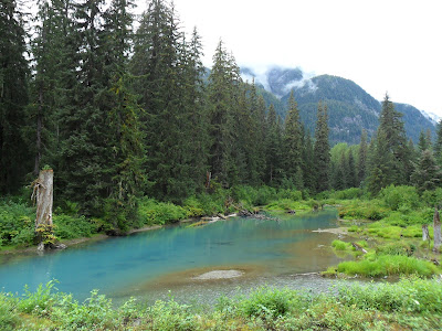

The salmon were just lazing around in the water. I think they were pretty tired out from all the swimming they had to do to get here. They were pretty territorial and would chase each other out of their sandy burrows. We don't know much about salmon spawning. Maybe they were just resting up here, or maybe they were making baby salmons. Whatever, it was cool. We did not see any bears here (or anywhere). There's a cache nearby, and other people who found it on the day we were there did see both black bears and grizzly bears. We were going to stop back here on the way back from Salmon Glacier, but we had other things to worry about (see previous posts).

An old fireplace on the way back to the van. We wondered what its story was.


Next cache - at an old gold mine. Roads? Where we're going, we don't need roads!


Old mine equipment.


Waterfalls
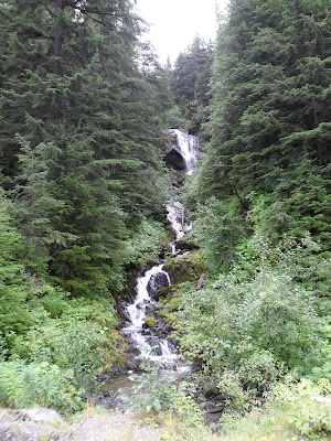

And more waterfalls.

Waterfalls ending in lakes.


Marmots.


Clouds. Behind these clouds are mountains and glaciers. We couldn't see them on the way up.


The mine entrance. On the other side of this tunnel is a turnaround with a cross. That cross made me remember not to worry, even though we had a flat tire and would travel 450 miles on a donut spare. And there's a cache just inside the entrance.


This empty lake bed is either empty or full. There is an ice dam at the foot of the lake which holds in the runoff from the glacier. When the ice dam finally breaks, in June, there is a flood of water way downstream.


Salmon glacier. This one runs for miles and miles, just like a river.


Leaving Alaska. US customs didn't care that we were entering, but Canada customs did.