Wednesday, August 06, 2008

Boulder

We took a tour of Boulder and the Celestial Seasonings plant. We got on a bus with a lot of other statisticians and left Denver around 9am. Along the way, we passed a rest stop, then a lady with a parasol, then a man. We turned to each other and said "geocachers." I turned to look at the man, and sure enough, he was intent on some box in his hands. Rich found that cache later in the week.

Here is some artwork that you might see on a box of tea.


Drinking tea at the tea shop. They make >150 flavors of tea, chai, and coffee. You can taste all of them in the tasting room.


A dress made of tea bags.


This is the sewing machine the Celestial Seasonings guys used to make the muslin bags they sold their first herbal teas in. They sold loose-leaf teas in those bags. No more loose-leaf now, but they are looking into it again, since it's becoming popular again. Their current bags don't have strings and tags so they can save money. Lots of money in strings and tags.


After the tour, we went to the Pearl Street Mall and had lunch. Food porn. Pasta Jay's. Nuff said.


Di tries not to be seen.

Tuesday, August 05, 2008

Caching!

We stopped for a few caches along the way to our unsuccessful hunt for Pike's Peak. One of them was at a nice lay-by.

Rich is up the hill!


He finds the cache!


Will he make it down again?


Yes! And here's a view of the Platte River from near the cache.

Monday, August 04, 2008

Red Rocks again

That last post was really a test to see if I could blog from flickr. But as far as I can tell, it only allows me to upload one photo, and that's no fun.

This is the amphitheater. It's a little dark, but you might could make out the seats in between the rocks.


The sign says there's a $999 fine for climbing on the rocks.


Really amazingly pretty rocks.


Some mule deer came down the mountain just in time for us to drive by.

Sunday, August 03, 2008

Red Rocks


P8020126
Originally uploaded by dirich92
We've always wanted to visit Red Rocks park and amphitheater, since the Moody Blues played there mumble years ago. When we checked in at our hotel, we decided to find Pike's Peak and ended up here instead. We did make it to Pike National Forest, more on that later. But we spent a lot of time driving around Red Rocks, taking pictures and watching people.

Saturday, August 02, 2008

Denver!

Rich and I made it safely to Denver today. They have paper airplanes hanging from the ceiling in the train tunnel between terminals!


Welcome to Denver...


Here is our car, a bright blue PT Cruiser. It's fun to drive. It would be a lot more fun with cruise control. We spent the day driving around Red Rocks and caching. Pictures and details tomorrow.

Wednesday, June 25, 2008

Home again!

I don't have any really cool pictures to show of the last two days home. We did stop by one of Robert Johnson's three gravesites in Mississippi. That was cool. But it was pretty ordinary travel down a flat road through MS, AR, and Texas.

We found caches in 15 new states. Check out our new map of found states! (Iowa should be on there, but I found out last night that I hadn't logged the Iowa cache yet)

Thanks for coming along with us again. It's good to be home.

Saturday, June 21, 2008

Three States and Two Time Zones

This is the spot where TN-AL-GA come together. It's also along the line where the Eastern and Central time zones come together. It's got a fairly nice trail headed up to it, but it's covered in poison ivy. We wiped down with baby wipes afterwards, and so far, 24 hours later, no itching.


Yes, there's a geocache hidden nearby, with lots more poison ivy to wade through. Massive baby wipes wipe-down and tick patrol ensued.

Andrews town

Lookie what we found! Andrew's town!


We stayed here a long time -- had lunch at Andrew's Mickey D's, found a geocache at Andrew's rest stop, and rang a bell at Andrew's train station, part of the Smoky Mountain Railway.

Blue Ridge Parkway

The Blue Ridge Parkway is a 469-mile road and one of the prettiest drives in the U.S. It goes from Smoky Mountain National Park in Tennessee to Shenandoah National Park in Virginia. It was built in the 1930's as a Depression-era public works project.

We picked it up near Asheville, NC and got off in the Cherokee Indian Reservation.

Entering:


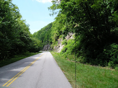
Typical of the scenery. There are many overlooks, one at least every 3-5 miles along the way. The speed limit is 45mph along the entire parkway, and most of the time we were doing under that so that the driver (me) could see the scenery as well.


Lots of fun tunnels.


This is near the highest point of the parkway, 6033 ft according to the sign, 6047 ft according to the GPS, and I see 6047 according to a map, best two out of three wins. We had lunch at an overlook and our view was similar to this picture. There's a fire tower on the hill in front of us, along with some antennas.


Beautiful escarpments covered in green.


One day, we'd like to come back and travel the entire distance. We passed a lodge on the way, and a number of visitor centers. There were not as many bicyclists than I had expected.

One funny story -- back at the giant peach, we noticed a motorcyclist taking pictures of the peach when we were there. We especially noticed him because of the bright green fleece jacket he had on. At the last overlook before the end of the parkway, we noticed him again -- more than half a day after we saw him in S.C.

The Giant Peach

Literally just before we stopped for the night in Gaffney, South Carolina, we saw what we had been looking for the entire trip: a giant peach. I knew we would see one, I just didn't know where or what form it would take. This giant peach took the form of a water tower. It has even won awards for best water tower. Who knew?


Obviously, there's a geocache hidden nearby, and obviously, we had to find it. The first stage was to look at a plaque commemorating the guy who the park is named for and get some numbers. The problem is, I didn't write down the instructions before leaving the hotel, reasoning I could get them from my phone at the site. I chose...poorly. The cache owner had used omegas and phis and other strange characters to denote the numbers we were supposed to pick up at the plaque. Some of these, but not all, did not render on my phone's web browser.

I used my razor sharp memory to make a guess at the coords, saw where the trail went (through the blackberry briars) and sent Richard off to find the cache. After 10 minutes, when he hadn't come back, I remembered a bit more about the cache page, to be specific, the terrain rating was much easier than the trail I had sent him down. I concluded my razor sharp memory was not as sharp as I had remembered. Luckily, Rich came back from his adventure, I cleverly found another permutation of the numbers which made a whole lot more sense, and off he went again into the briars.

Two minutes later, he came back with a duct-taped ziplock bag. Interesting container. I read the outside, opened it up, and discovered it was a letterbox. The clue was when the contents said, "This is a letterbox. It is not a geocache. It is not trash." I thought that was funny. Rich, bless his heart, went back one more time and in one minute was back with the real cache.

The cache was loaded with goodies and the kids made good trades. Rich's legs are feeling *much* better now, but they look pretty scratched up. The next day, he waded through woods of poison ivy, so everything's relative. More on that later.

Why we drive the little roads

We've been staying on state and US highways, trying to avoid the interstates. It adds many miles and many hours to the overall trip, but my goodness, this is much better than straight flat roads through trees.

Somewhere in North Carolina:


Somewhere on the Blue Ridge Parkway:


Somewhere near the TN/GA border:


The Road Not Taken, by Robert Frost

Two roads diverged in a yellow wood,
And sorry I could not travel both
And be one traveler, long I stood
And looked down one as far as I could
To where it bent in the undergrowth;

Then took the other, as just as fair,
And having perhaps the better claim,
Because it was grassy and wanted wear;
Though as for that the passing there
Had worn them really about the same,

And both that morning equally lay
In leaves no step had trodden black.
Oh, I kept the first for another day!
Yet knowing how way leads on to way,
I doubted if I should ever come back.

I shall be telling this with a sigh
Somewhere ages and ages hence:
Two roads diverged in a wood, and I—
I took the one less traveled by,
And that has made all the difference.

Friday, June 20, 2008

Showers

I've complained about this before, but after almost 3 weeks of hotel/motel living, it's time to complain again. I've seen a lot of fancy showerheads since I last showered at home. Some with massages, some with different kinds of spray, some crusted with lime or rust (yuck!). They invariably have one thing in common -- a hole in the spray due to the pattern of water coming out of the head. This has always bugged me about American showerheads. That's why I have a showerhead which is simply round with holes poked in it, in a pleasing and functional radial pattern.

There are some good things about American hotel/motel showers. Whoever thought up the rounded shower curtain bar is a genius. This thing holds the shower curtain away from the tub at the top, so the curtain tapers down to the tub, and your tummy isn't constantly bumping up against and sticking to the shower curtain.

Another good thing is that the vast majority of these showers actually have more than enough water pressure. And the showerheads are really high on the wall, terrific for someone as tall as I am. I have bad memories of having to do backbends to rinse my hair in a trickle of water.

On a related note, the beds in hotel/motels have gotten a thousand times better in the past 10 years or so. These are tall enough that my legs dangle over the sides, soft enough that I can sleep all night, the sheets stay tucked in (for the most part), lots of pillows, just the right amount of covers, soft sheets, and sometimes, like last night, we get a room with a KING bed and pullout sofa and I sleep like a baby all night.

Next needed improvement -- taller toilets.

Wednesday, June 18, 2008

Leaving North Carolina

It's time to start the drive back home. I'm looking forward to it. It's been a really long week of thinking. It will be good to use a different part of my brain for a while.

Anagrams for North Carolina:
Loch Narration
A Cilantro Horn
Oh Cranial Torn
No Racial Thorn
Rot Canal Rhino
Anal Iron Torch
No Choral Train
Chart Roan Lion

This hotel has a tennis court. Picture a six and seven year old playing tennis. It's funnier in real life.

Connor's blog


It's a whole new perspective!

Friday, June 13, 2008

Painting a bridge

On the way back to Kentucky, we crossed a bridge over the Ohio River. They were painting the bridge, so of course, we chose the lanes they were painting. They were the slower lanes, but we chose them on purpose because on the way over, we had seen that...


...they had put up a tent over the bridge. How cool is that?


Actually, it was really hot and stinky in the tent and we were glad to get out into the sunshine again.

Super Stop

Yes, we were in Metropolis, Illinois! Guess who we saw there??


Truth, Justice and The American Way!


Here's where we parked.


And a reminder of the need for superheroes in the county courthouse also located on Superman Square.


The town has a Superman festival and they were celebrating the 30th when we were there. There were funnel cake trucks set up ready to party. We couldn't stay though, there was another cache to get in another terrific park with a playground, pond, ducks, and a giant Indian head carved from a 58,000 pound oak tree (according to the sign).

Ft. Massac

We were going to hop over to Illinois and pick up a quick cache, but ended up spending the morning at Ft. Massac.


It was built by the Spanish in the 1500's, taken over by the French, then the British, then the Americans, when George Washington garrisoned troops there.


This is a replica of the fort. The real one is just next door, all that remains is the location of the buildings. The buildings had the original hardwood floors (!) and rudimentary furniture like bunk beds (no mattresses) and tables. Some had fireplaces. I think those were the officers' buildings.


Clark (of Lewis and Clark) visited here, and there are plaques with his name on them in the old fort.


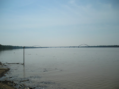
This is the view of the Ohio River from the fort. I suppose if the Indians had bridges, the fort-holders would be in much more trouble.

A big tractor had just come by to remove flood debris from the boat ramp. He just pushed it all back into the river.


The first row of stakes is in a moat. There was no water in the moat, but there was a faucet nearby. No crocodiles, either. The post in the middle is a flagpole.


There are steps up the flagpole. I thought it was a lookout tower, but it really is a flagpole.


We did find the cache. It was a nice walk through the woods to an easy find. The boys had brought along items to trade and went away happy. We then drove to the fort and found 5 playgrounds on the way. The boys were very impressed.

Thursday, June 12, 2008

Caching and playing in Salem, Arkansas

We found a super park with a pond, ducks, geese, a playground, a hill, and ... a geocache. Here's the obligatory kid shot.


The boys try to lure some geese with corn. This park had one of those machines like you see at stores -- you put in money and out comes nerds or M&Ms. This machine had corn in it. We weren't sure if the corn was for the squirrels or the geese, but I'm sure they all enjoyed it after we left.